
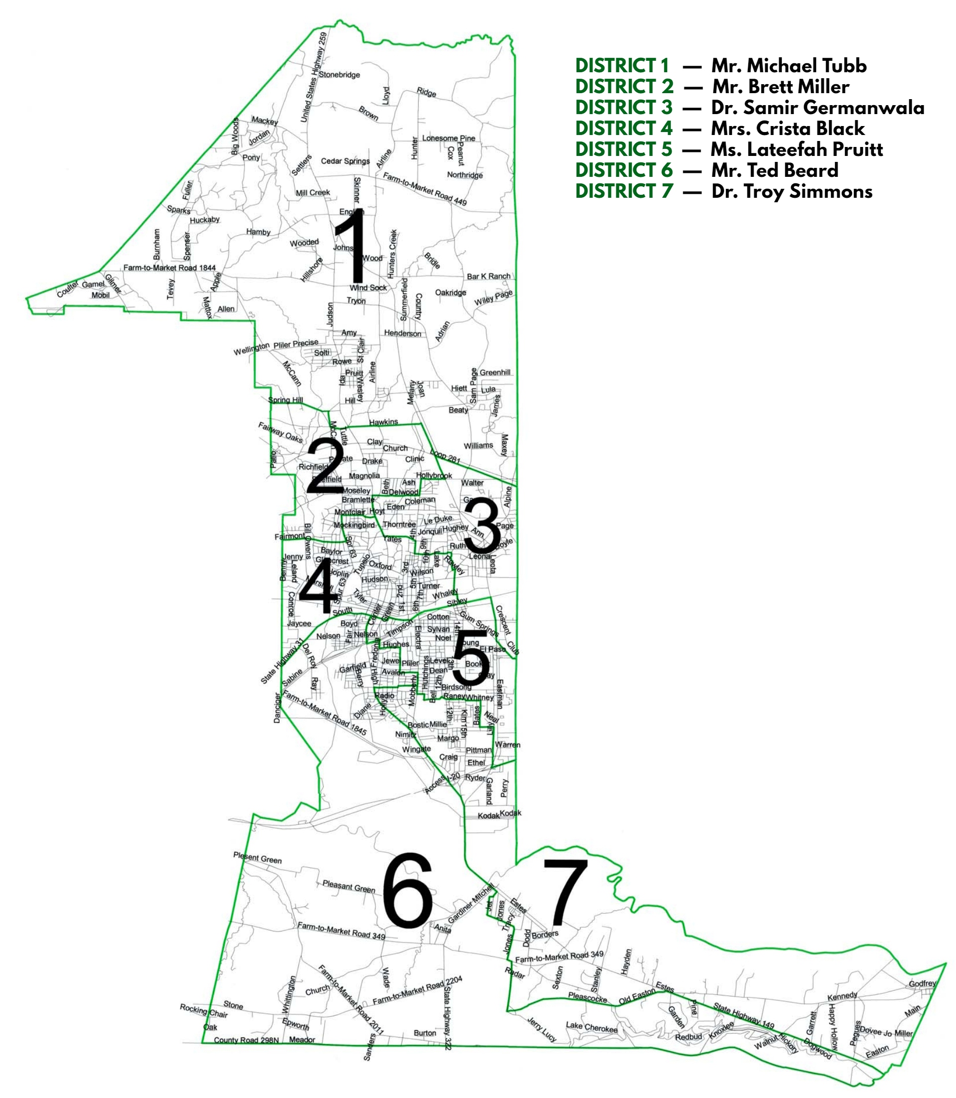
Find schools of attendance by:
- Specific address - enter/select an address from the search field
- Specific school - toggle school layers to see respective boundaries
- General area - click/hover on any portion of the district layer, e.g., near Main St., east of the park, etc.
 toggles the display of the panel
 toggles the menu that displays boundaries, schools, and additional layers
 returns schools of attendance for your detected location; GPS must be turned on and supported and/or user must share device's location. (Please note: detected locations are not recorded nor are they shared with other parties.)
 toggles full screen mode. (Please note: Full screen functionality is not supported by all browsers on all devices; if experiencing problems, please use this version.)
- The most recently displayed layer is added to the top of the map and key
- Reorder layers by clicking on a key entry - this moves the respective layer to the top of the map and key
- On larger devices, the map canvas can be used with the panel open
- Real time feedback is available on devices with a mouse
Any additional questions or concerns should be directed to Community and Media Relations (903) 381-2200.
If the map does not display you can download a .pdf file of our district map: